Exploring Romania’s wild and vast Carpathian Mountains will be a unique and memorable experience for tourists who don’t know what to expect. Romania has a lot of potential for hiking, trekking, backpacking trips, mountain biking, climbing, and all things outdoors – even though it’s a less known destination for this. Which is exactly why you should consider visiting Romania for your next hiking vacation!
Boasting a wide variety of hiking trails that wander through stunning natural landscapes, majestic peaks reaching 2,500m altitudes, dense woodlands, plenty of natural attractions, quaint little villages still unspoiled by the touch of the modern world and a rich wildlife population, Romania rightfully deserves the title Europe’s last wilderness reserve.
The Carpathian Mountains dominate the country’s relief and circle the famous region of Transylvania which is a popular destination for tourists all over the world. So for those of you who want to go hiking in Romania, explore the Carpathians and discover the wonders of Mother Nature – we’ve got you covered. In this article we’ll tell you about three places you can go hiking in Romania and how to plan your trip.
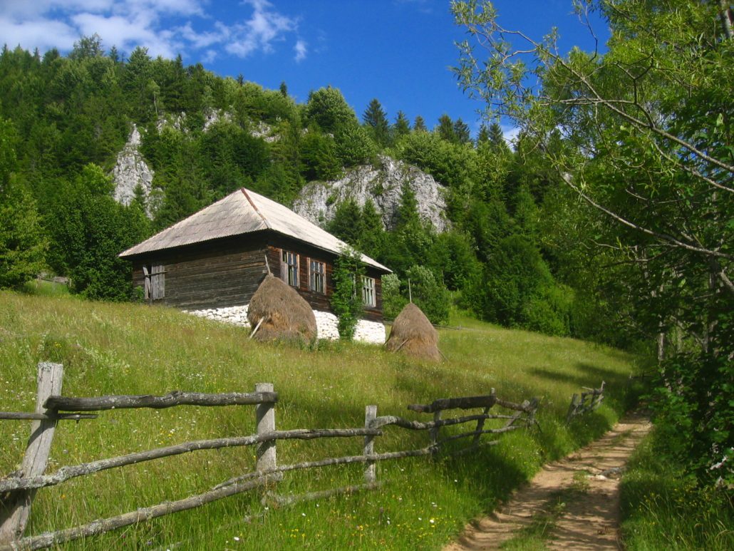
Hiking in Piatra Craiului Natural Park
Piatra Craiului Natural Park – hiking trails for all experience levels
Rising at the eastern extremity of the Southern Carpathians, Romania’s Piatra Craiului mountains are a favourite among hikers and climbers for the best hikes in Romania.
This range might not be the largest, nor the highest (the maximum altitude is reached at La Om Peak at 2,238m altitude) in Romania, but what really captivates hikers are the distinctively rigged limestone summits which are unlike any other mountains in the area. The unique crest scratches the sky like a natural barrier and magically draws hikers – and all eyes – to it.
The mountains in Piatra Craiului also boast rich vegetation and animal life which is why it’s also a natural park. Enjoy some of the best hikes in Romania while taking in stunning scenery.
There are plenty of trails in Piatra Craiului for all experience levels. They’re perfect for hiking day trips for medium experienced hikers or for family trips with kids.
If you’re a beginner, the best option would be following the trail that takes you from Fântâna lui Botorog, all the way through the Zarnesti Gorges, with spectacular vertical walls bordering the valley (which are also popular for rock climbing), continues towards Cheia Pisicii, and ends at Valea Vlădușca. It’s a 6 hours trail in general, but it really depends on your pace and how many stops you make along the way.
You can also check out the trail that goes uphill to Curmatura Hut (the only accommodation in the mountains) also starting from Fântâna lui Botorog. The hike takes just under three hours and is available all year round.
You’ll begin your ascension following the indicators on the left side of the fountain, through the forest, until you reach Poiana Zanoaga. Here’s where the path splits in two, and you’ll have to follow the yellow markings until you’ve finally reached Cabana Curmatura, a beautiful mountain chalet that also serves as a starting point for the trails going up the ridge of Piatra Craiului.
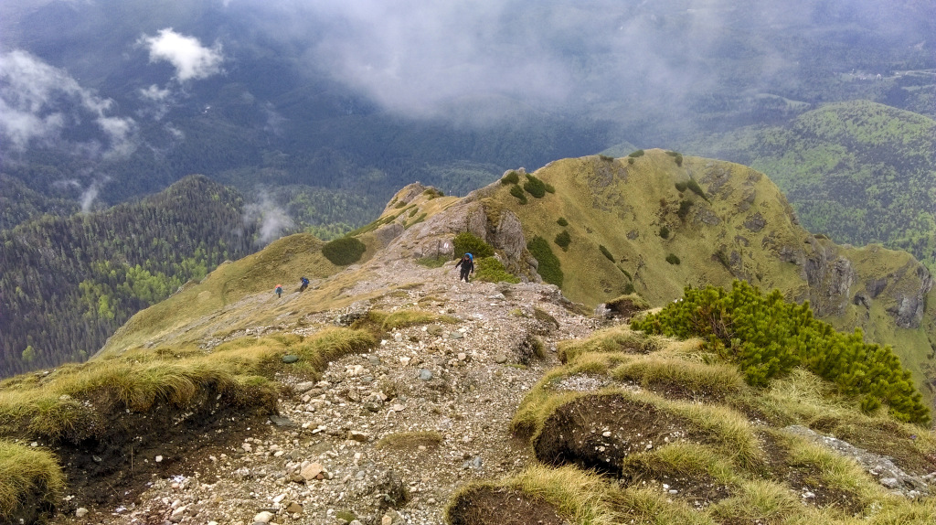
If you’re looking for more challenging trails towards the ridge or even to summit La Om Peak, these can be done in one-day hikes of approximately 8-10h starting from Pestera village.
These hiking trails in Romania are recommended for experienced mountaineers able to sustain effort and a quick pace, and we would recommend hiring a hiking guide as it’s easy to get lost especially in the evening as it gets dark. Besides the challenge, you’ll be rewarded with stunning views of the Rucar-Bran Corridor and Bucegi Mountains if the weather is on your side.
Hiking in Bucegi Mountains
Bucegi hiking in Romania’s Southern Carpathian Mountain range
Hiking trips in Romania’s Bucegi mountains are also very popular due to the massif’s proximity to Bucharest and the existence of cable cars in Sinaia and Busteni taking people up to the plateau and offering a very easy start to any hiking trip. It’s a two-hour trip to Bucegi from the capital and less than an hour from Brasov by either car or by train.
But it’s not just accessibility that makes Bucegi Mountains such an appealing hiking destination in Romania. The striking glacial landforms such as Valea Morarului, Padina Crucii, or Tiganesti glacial lake, the famous natural rock formations Babele and The Sphinx, the breathtaking views from Omu Peak at 2,505m altitude and the numerous circuit trails contribute to its reputation as one of the best hiking areas in Romania.
The town of Busteni, located in Prahova Valley, marks the starting point for most hiking trails in Bucegi, Romania. The cable cars from Busteni or Sinaia will take you straight to the Bucegi plateau at 2,200m altitude.
Once you’ve reached the plateau, you can continue your trip and visit well-known natural attractions such as The Sphinx and Babele rock formations, Bolboci Lake and Caraiman Cross where you’ll get superb views and, if lucky and the sky is clear, see the Black Sea 350 km away!
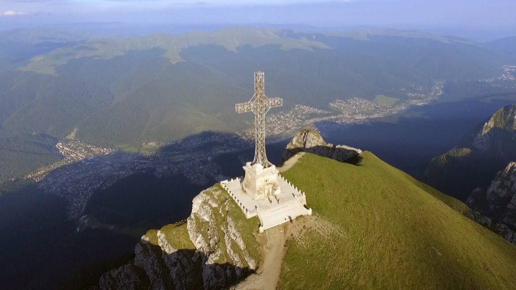
Heroes’ Cross on Caraiman Peak with its spectacular view over the Carpathian Mountains
Since Bucegi is quite a compact massif, you can cover multiple hiking trails on the same day. From Babele, you can easily reach Omu Peak after only a 3-hour hike one-way, or head towards Crucea Caraiman, following the red cross markings.
Compared to some of the other best hikes in Romania, both of these treks are very easy, even for inexperienced hikers, so you don’t need any special gear apart from adequate footwear and clothing.
One thing you should keep in mind when planning a hike in the Bucegi Mountains is the popularity of the mountain resorts at their base and the accessibility of the mountains which attracts many people who want to spend time in nature.
This can often lead to traffic jams on the road, queues at the cable car, fully booked accommodations and a large number of tourists walking these trails on the plateau, especially during summer months in Romania. That’s why it’s best to plan your trip early on if you intend to stay overnight at one of the mounting cabins nearby.
Hiking in Apuseni Mountains
Trekking in the Apuseni Mountains in Romania
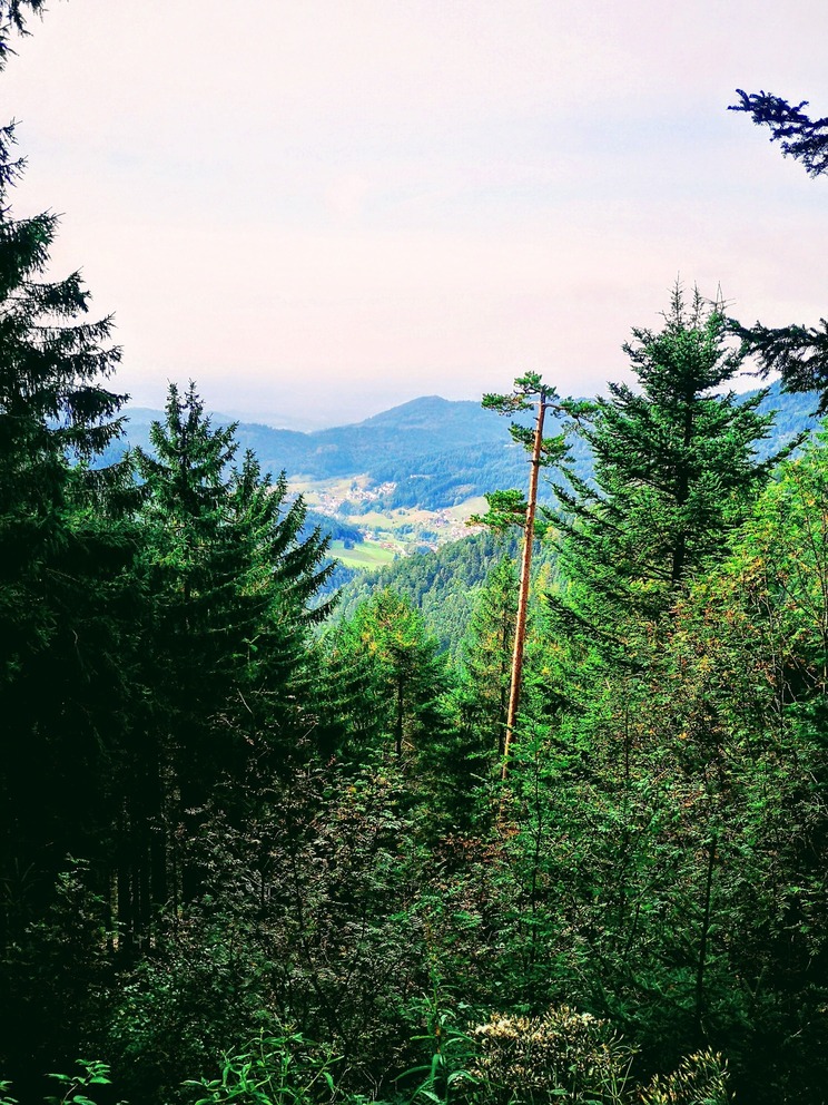
The Western Carpathians formation South – West of Cluj-Napoca are generally known as Apuseni Mountains although they contain many ranges and Apuseni Mountains and Natural Park is only a small part of it in the South.
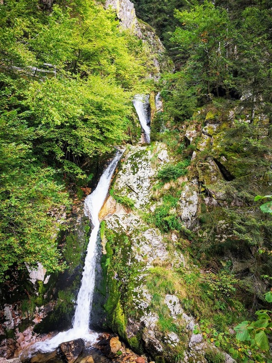
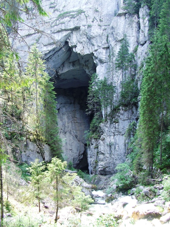
Nevertheless, these mountains have a special appeal for outdoor lovers being one of the most popular hiking destinations in Transylvania, Romania. The Carpathian mountains have many natural attractions among which numerous caves (400, to be more precise) including glacial caves like Scarisoara Cave, karstic landscapes ideal for via ferrata and rock climbing, breathtaking waterfalls and beautiful picturesque valleys.
There are many scenic routes that you can wander on in Apuseni National Park, but also plenty of places to rest and relax. Given that the area is densely populated and quite well developed, there are many accommodation options to choose from in small villages like Marisel, Rachitele or Garda de Jos.
Besides having an easy starting point for your hikes, you’ll get a feel of the local Carpathian community by staying in traditional guesthouses, eating home-grown products and immersing yourself in Romanian culture and traditions.
Cetațile Ponorului in the Apuseni Mountains
Cetațile Ponorului, Lumea Pierdut, Padis Plateau or Cascada Bulbuci are just some of the famous natural attractions that you shouldn’t miss on your trip to Apuseni mountains. If you want to see all of them we recommend hiring a hiking guide who can also transfer you by car between areas as otherwise you would need 8-10 days to explore the entire region and see all these beautiful sights.
Also, if you happen to reach Vladeasa massif, make sure to check out Pietrele Albe, a fascinating limestone complex situated near Rachitele village.
A Note About Safety when Hiking in Romania
Wherever you choose to go on your hiking or backpacking trip in Romania, make sure to be prepared and do your homework. Hiking infrastructure is not very well developed with few signs or maps in English and few accommodation options deep in the mountains.
To ensure you have a great hiking experience in Romania, be sure to get the AllTrails app before you go. The app has an extensive list of the best hiking trails in Romania, with reviews from other hikers to keep you up to date on the latest trail conditions. You can filter by trail difficulty, length, and suitability and download trail maps to help keep you on track even when you’re offline.
Also, Romania is home to the largest brown bear population in Europe and many other wildlife so if you’re planning to go hiking in Romania on your own, consider taking a pepper spray with you or hiring a guide who knows what to do in these unexpected encounters.
Pin The Best Hiking Destinations in Romania