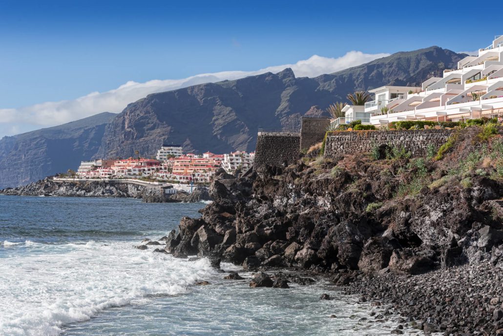
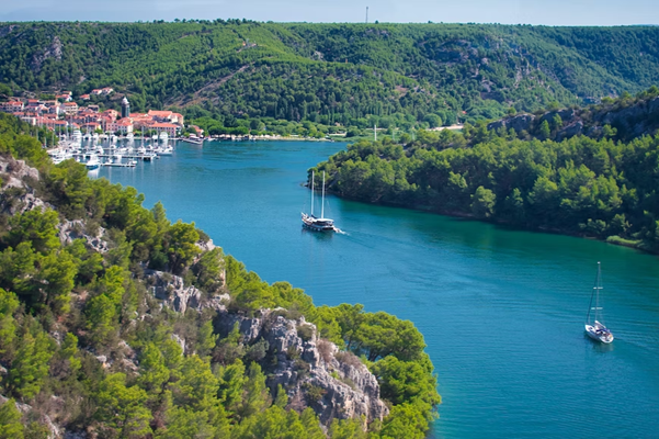
While many visitors year-round prepare for a visit to mainland Spain, the country is also known for its beautiful islands. The Balearic Islands are located near the mainland in the Mediterranean Sea while the Canary Islands are in the Atlantic Ocean off the coast of Africa.
If you are wondering if Tenerife is worth a visit, enjoy this resource on the top hidden gems throughout the island. While the Canary Islands are made up of eight main islands, Tenerife is the largest and most populous. It is an extremely popular choice as a travel destination and is known for its beautiful beaches, great sea-view restaurants, and family-friendly attractions.
The island is also a great option for those looking for a less-touristy place to visit and an authentic experience, with many places to find solitude in Tenerife.
Tenerife’s landscape and attractions widely vary from the north to the south of the island, each offering its own unique charm. Local villages boast scenic views throughout the island and the people of Tenerife are warm and inviting. If you have a short stay coming up on the island, don’t miss these top nine hidden gems in Tenerife that will ensure you see the best that the island has to offer.
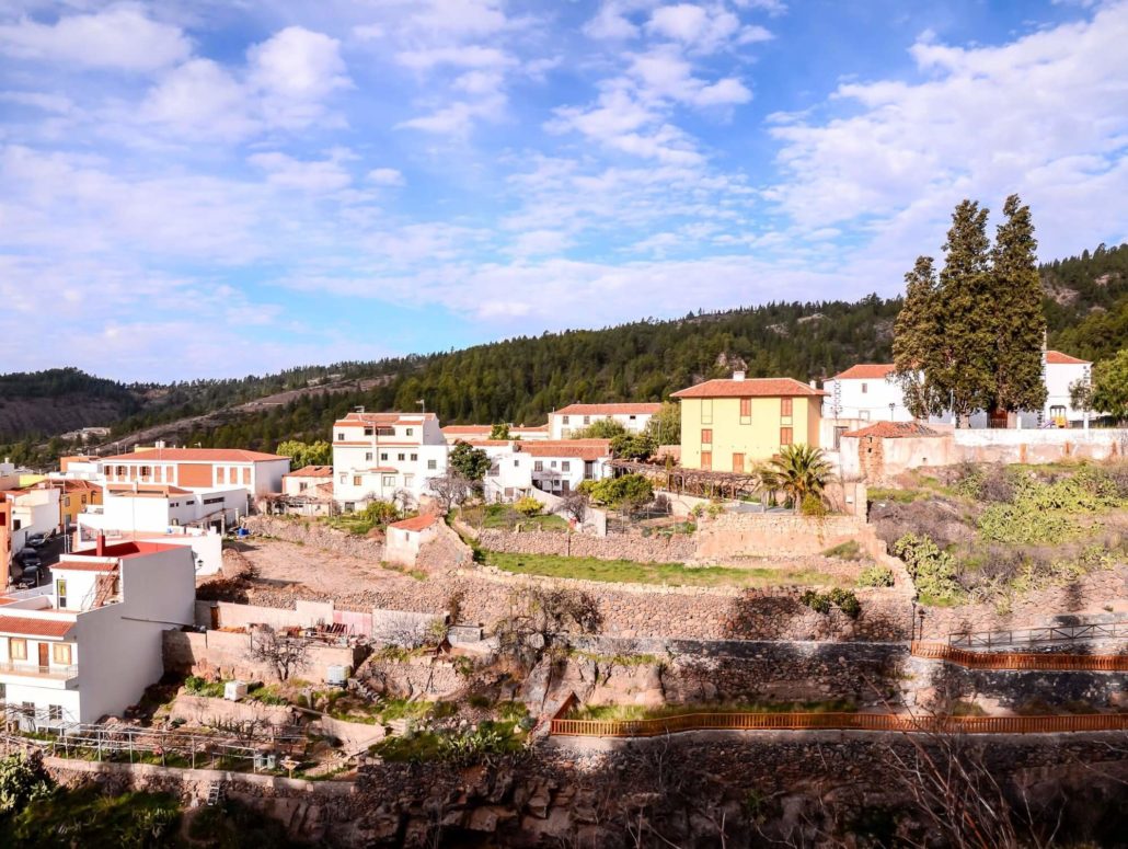
Vilaflor Village

Vilaflor Village
I recently returned from Tenerife and without doubt, my favorite area was Vilaflor Village. When you think of the island, you may assume you’d only see scenes of beaches, sand, and shoppes in a big city like Costa Adeje, but a trip to Vilaflor Village offers the opposite. Located in a mountainous region in the southern part of the island, Vilaflor offers mountainous views high above sea level, charming village homes and churches, and some of the most delicious restaurants in Tenerife.
Located near Mount Teide, an active volcano that offers great climbing opportunities, Vilaflor is a rural Tenerife town with great rural landscapes and pine forests. After viewing lots of deserts throughout the island, visitors will enjoy the sights from the highest village in Tenerife. From the beautiful main square, you can enjoy traditional architecture beaming with history and wonderful sightseeing points overlooking the island.
In Vilafor Village, do not miss the opportunity to dine at Los Cipreses De La Casa Inglesa. Located in a local inn, this family-owned restaurant offers fresh ingredients, excellent service, and the best views in Vilaflor. The food and local wine are exceptionally prepared by a skilled kitchen staff and their staff make visitors feel like they are enjoying a meal amongst friends.
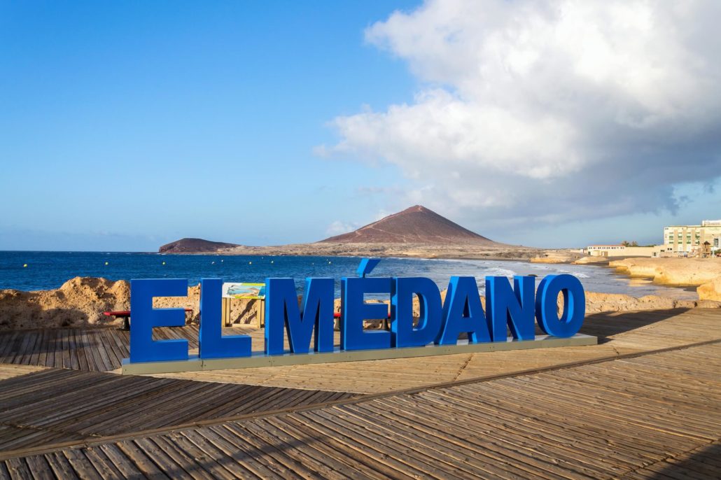
Quiet Spots in El Médano
El Médano
One of the most known villages in Tenerife is El Médano, found on the southern tip of Tenerife. El Médano is known to have the longest and one of the best beaches in Tenerife. Along this oceanfront promenade, it is common to see locals and tourists windsurfing and kitesurfing with bright-colored sails filling the sky. This village is a perfect choice for those who enjoy outdoor activities and watersports as the opportunities there to enjoy those pastimes are endless. El Médano is also a scene filled with beach bars and nightlife, making it seem like a very active village. If you’re looking for solitude and a space to yourself, you can find some peace in El Médano, too, but you just need to search for it.
Peace and serenity are found as you travel south down the south in El Médano, arriving at the wild, windy, and untouched Montaña Roja. Known as the red mountain of Tenerife, the unique volcanic landscape makes visitors feel so remote that it seems like they’re on a different planet. This mountain is easily climbable and possible for children of all ages due to several clearly marked path signs and trails. There you can find peace and quiet beyond the beaches of El Médano.
Bajamar’s Hidden Pools
Bajamars Hidden Pools
One of the best features of Tenerife and the Canary Islands, in general, are the several different piscinas naturales offered throughout the islands. Piscinas naturales are natural swimming holes that have formed off of the ocean, providing a hidden oasis for cooling off in the hot sun. While many of the swimming holes are stunningly beautiful, the hidden pool at Bajamar is a hidden gem that you cannot miss. Piscinas Naturales de Bajamar located on the northeast end of the island, offers several large pools and a smaller option for young children. This hidden gem offers a safe and natural way to swim in Tenerife and is in a great location near many great sites on the island.
Families will love to know that this natural swimming attraction is recognized as one of Tenerife’s most family-friendly waterparks. The view of the water, sand, and a nearby lighthouse make this attraction a great choice as a hidden gem in Tenerife. After a day swimming in the beautiful natural pool, Bajamar is located near some wonderful attractions in Tenerife including the popular UNESCO World Heritage Site, La Laguna.
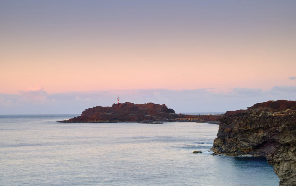
Punta de Teno Lighthouse
Punta de Teno Lighthouse
The journey to get to this remote lighthouse is a bit far from the southern Tenerife area, yet it’s worth every moment to find total serenity. Punta de Teno Lighthouse is a hidden gem tucked into the far northwest corner of the island, between the beautiful mountains of Masca and the Atlantic Ocean. This village evokes serenity and guests will love the untouched and protected oasis of Puna de Teno. The lighthouse in the village is a stunner, constructed back in the 19th history beaming with colonial backdrops. To find this lighthouse, you must pass through the known village of Buenavista and tourists will find this attraction about twenty minutes away. The process of getting there involves windy, twisting mountain roads, so drive or bike there with caution.
Punta de Teno Lighthouse is most often visited during sunrise and sunset for wonderful photography opportunities, yet visiting this site would be good any time of the day. To find smaller crowds, consider visiting in the middle of the day when most tourists frequent local beaches. A recommended hike there for great views of the ocean and lighthouse is the Camino del Risco to Teno Alto trails.
Cueva del Viento
Not everyone will find it peaceful to squeeze into a lava tube, but if exploring a wind cave has been on your bucket list, you may just find some peace there. Cueva de Viento is a volcanic cavity located in the village of Icod de los Vinos. Potholing, or navigating this wind cave is a unique experience and doesn’t draw many crowds, making it a great hidden gem in Tenerife. Two-hour tours are available for visitors interested in learning more about this wind cave and cave experts may find opportunities to explore the cave further. This activity is not acceptable for children under the age of five.
The mysterious ambiance of the wind cave is familiar to locals, known as Guanches, as the indigenous peoples of the Canary Islands are very familiar with volcanic activity formations. For visitors to Tenerife, though, those less familiar will admire the interesting topography of Cueva de Viento. To enter, guests must access with lit helmets into tight spaces, so spending time alone in this wind cave may not be for all wanting to uncover hidden gems in Tenerife.
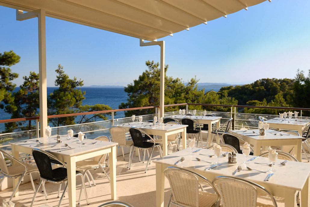
Gastronomic Delight in Costa Adeje
Gastronomic Delight in Costa Adeje
If you are familiar at all with the island of Tenerife, you know that Costa Adeje is a bustling area of nightlife, restaurants, and shops. While the terms hidden and Costa Adeje may not seem synonymous, there are many lesser-known culinary experiences there that cannot be missed. These best restaurants in Costa Adeje offer sea views, great food, and in many cases, fewer crowds. Whether dining out as a family or wanting to find a remote and cozy spot to dine as a couple, this previously sleepy village in Tenerife is a lively scene for gastronomy.
There are hundreds of incredible eateries along this stretch of coastline but these highlighted restaurants offer something extra special. Choose from Mediterranean, European or Spanish dishes with many focused on paella or freshly caught fish dishes. While the food at each of these offerings is incredible, the ambiance and setting for a private, remote dinner make this event a true hidden gem. First-class service, delicious homemade wine, and views overlooking the Atlantic make this experience ideal for couples or families who are looking to make everlasting memories in Tenerife.
Hidden Beauty of Los Silos
Hidden Beauty of Los Silos
If you’re looking to take an adventure in Tenerife that will reveal untouched beauty and offer cultural events, you can’t miss Los Silos. This historic area hidden in the mountains of Aregume is surrounded by colorful gardens and for Tenerife it has become a powerful symbol of the islands. At its center is Iglesia de Nuestra Señora de la Luz, a famous statue that has a festival named after it on the islands. There is significant history behind this statue and this area predates the 1600s with Portuguese references. It is here that tourists will find solitude and spaces in gardens to unwind from the busier lifestyles on other areas of the island.
Located on the northern coast with the rugged Teno mountains in the background, Los Silos is close to the gorgeous coastal town of Garachico which also offers a great day trip from southern Tenerife. Besides the church in the plaza of Los Silos, art enthusiasts can find the famous painting of the Martyrdom of San Sebastian. This is known today to still be Tenerife’s most valuable piece of artwork on the island.
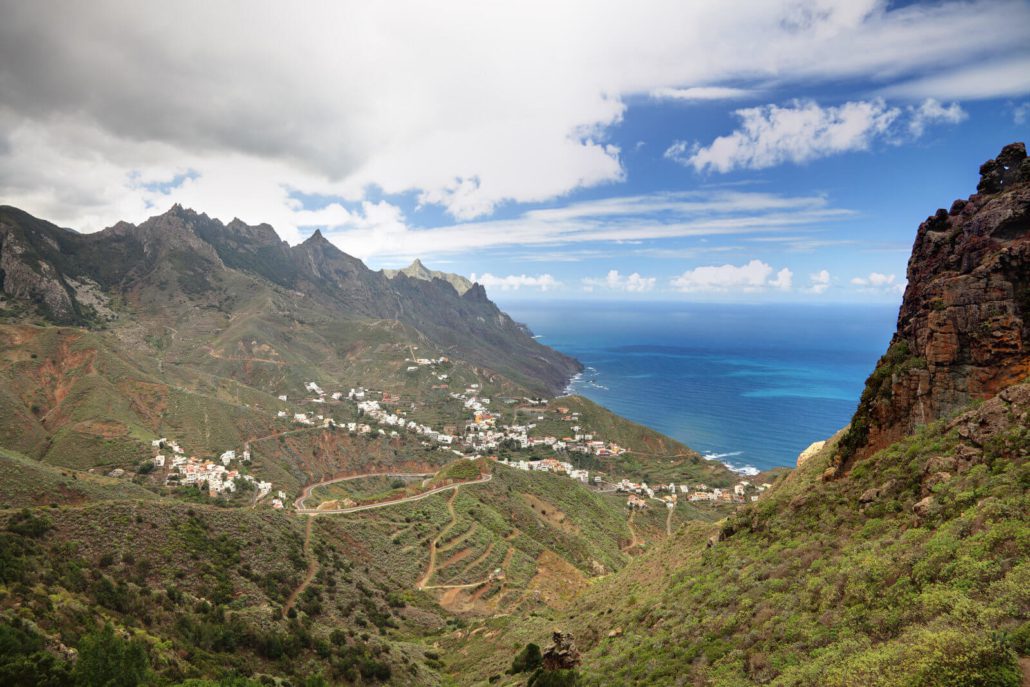
Mystical Taganana
Mystical Taganana
If you’re looking for a true hidden gem in Tenerife, there is a small village called Taganana which equates to true peace and quiet. Located in the reserve area of Anaga Rural Park, this option is a great one for those on the southern end of the island who are seeking a slower pace. As one of Tenerife’s oldest villages, Taganana has dramatic landscapes, giving a small village allure that many locals and tourists have come to love. The best way to reach Taganana is by driving through one of Europe’s oldest forests, Las Mercedes forest, on a windy road in between ravines. I’m not sure if a location exists in Tenerife that could feel more remote!
In the center of the village, you will find Nuestra Señora de las Nieves square, which is a quiet place among laurel trees that locals know well. The topography of Taganana is unique, and the mountain town offers specialty activities like local stone presses and Portuguese neighborhoods unique to that area. If you are searching for a cultural activity while in Tenerife, visiting Taganana is the best option of all.
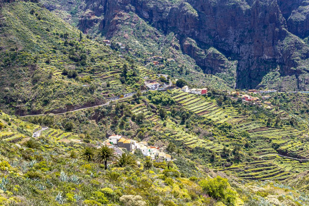
Secrets of Masca Village
Masca Village
If driving up winding, mountainous small roads and holding tight onto the seat handles is for you, you’ll especially love Masca Village. All in fun, the ride up to the mountain village of Masca is thrilling but should not be taken by those skeptical of driving on the windy roads. Once the drive is complete, you will be enamored by the beauty of this village. Even from the car, travelers experience breathtaking mountain views and can pull over to many scenic spots to take pictures. If you hike or bike, Masca is also known as one of the best spots to get outside and do recreational activities. Due to its extremely high altitude, pack a light jacket for a trip to Masca as the temperatures up there are dramatically cooler than in the more desert-like areas of Tenerife.
Masca remains a hidden gem for many due to its mix of mystery, as many locals believe that many years ago, pirates hid out in these mountains. Although currently known as a much more tourist-driven spot, Masca Village definitely has fewer tourists than more popular spots like Costa Adeje.
Getting Ready for Tenerife
The time has come for your trip to Tenerife and prepping your plans to include less-crowded places will immensely help the process. It was important and very valuable for me to have a car while exploring Tenerife as there are many hidden gems both in the north and south ends of the island. While biking is also common in Tenerife, having a car secured is an important step to make sure you can get to more remote places. I highly recommend Top Car, a locally-owned Canarias car rental site that has affordable car rentals.
When looking for accommodations for your trip, be sure to map out which hidden gems in Tenerife you hope to explore most. It can take over an hour to travel from the south to the north end of the island, so positioning yourself near those sites you want to see most would be helpful. I stayed on the south end of the island, closer to Costa Adeje, yet I was easily able to travel to the north’s hidden gems, too. The culture and environment of Tenerife is nothing short of welcoming, with locals being so proud to call Tenerife home. In addition to these hidden gems in Tenerife, asking a local Guanche what their favorite areas are on the island may help you discover even more hidden spots.