Whether you are looking for outdoor adventure or a relaxing getaway, there is something for everyone just outside Sacramento’s city limits. Here are 17 incredible day trips from Sacramento that will give you an unforgettable experience!
Sacramento is an amazing starting point for a variety of day trips in Northern California. From the state capital, you can explore everything from the beaches of Bodega Bay to the wine country of Napa Valley and all points in between.
Grab some road trip essentials and get started on your day trip from Sacramento!
Folsom

Folsom, California
Time to travel: 28 minutes
Best time to visit: All year round
Just a 28-minute drive away, Folson is an easy day trip from Sacramento with plenty of activities to explore. Spend the day shopping at the Folsom Premium Outlets or simply stroll through Historic Folsom and take some photos of its iconic landmarks like the Rainbow Bridge.
Or check out one of the many trails in the area, like the Johnny Cash Trail or Lake Natoma Loop Trail. And don’t forget to stop by the Folsom City Zoo Sanctuary for some animal encounters.
Auburn
Time to travel: 33 minutes
Best time to visit: Summer, Fall
Another short drive away from Sacramento is the small town of Auburn. Located in Placer County, it’s known for its rushing rivers, majestic mountains, and endless outdoor activities.
Take a day trip from Sacramento to Auburn to start a hike at the Hidden Falls near the American River or Lake Clementine Trail. If you’re up for swimming, head on over to a gem of a swimming hole, the Auburn Confluence.
You can also walk the historic downtown of Auburn for cute boutique shops and restaurants. Check out The Pour for local coffee, go for wine tasting, or grab something more substantial at the Auburn Thai Garden Restaurant.
Lodi
Time to travel: 38 minutes
Best time to visit: Spring, Summer
With it being such a short drive away, Lodi makes an awesome day trip from Sacramento. Lodi is located right in the center of the San Joaquin Valley with sunny days and fields of greenery!
Today, Lodi is coming up in the wine industry and is recognized for its Zinfandel grapes. Besides wine country, there are also other adventurous things to do in Lodi.
Head to Lodi Lake for a swim or check out the unique animals found at the Micke Grove Zoo where zoologists are doing their best to take care of some endangered species hosted there.
You’ll also want to check out the local farmer’s market that the town has on Thursday evenings or head to the Double Dip Gallery for both ice cream and local art.
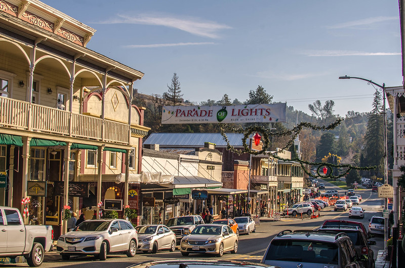
Placerville
Placerville, California
Time to travel: 42 minutes
Best time to visit: All year round
Another great day trip from Sacramento is to the town of Placerville. Located in El Dorado County, this place has a lot of history to it. It was the first large settlement in California and one time had the name “Hangtown” due to 5 men who were hung on the same day on the same tree!
Today, you can still walk around the historic downtown of Placerville and check out some of the oldest buildings in town. Visit local shops like The Bookery for books, head to the Lava Cap Winery as well for wine-tasting in Placerville, or visit the Larson Apple Barn for some of the most delicious apples!
For more outdoor activities, head over to Eldorado National Forest for hiking through trails like The Potholes, Bassi Falls, or Shealor Lake Trail.
Sutter Creek
Sutter Creek, California
Time to travel: 55 minutes
Best time to visit: all year round
Sutter Creek is a charming city in the heart of California’s Gold Country, located less than an hour from Sacramento. Explore its colorful downtown with historic buildings that date back to the 19th century and find a variety of unique shops and galleries along Main Street.
If you’re feeling adventurous, take a panning tour at the Kennedy Gold Mine and test your luck at finding some gold! You can also take a self-guided tour through the Black Cavern Chasm filled with crystals.
For fuel, grab a drink from Chocolatte, and head over to Cavana’s Pub & Grub for a delicious sandwich!
Nevada City
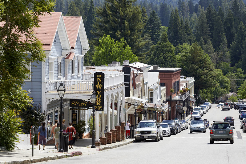
Broad Street in Nevada City, California
Time to travel: 1 hour, 2 minutes
Best time to visit: All year round
You don’t have to go too far from Sacramento to visit some of California’s oldest towns. Nevada City is located in the Sierra Foothills and is known for its well-preserved gold rush history.
Take a self-guided tour of the town’s historic sites, including the Nevada City Firehouse Museum or the Narrow Gauge Railroad Museum. You’ll also find some great restaurants, shops, galleries, and wine-tasting rooms in downtown Nevada City on Broad Street.
For food, head to the local farmer’s market on Saturday mornings, grab an almond croissant at the Three Forks Bakery & Brewery Co., or Lefty’s Grill.
Napa Valley
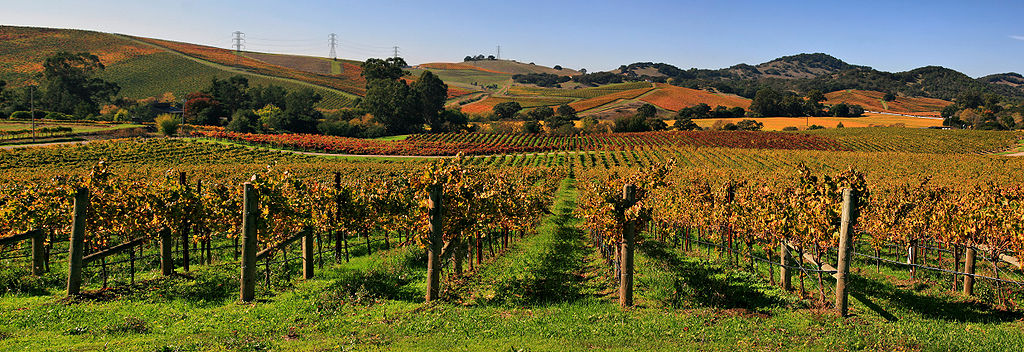
Vineyards in Napa Valley
Time to travel: 1 hour, 10 minutes
Best time to visit: Spring, Summer
Napa Valley is a great day trip from Sacramento for those wanting to experience world-class wineries and gorgeous vineyards. From tasting rooms offering samples of locally crafted wines to the many restaurants that feature local flavors, there are so many delicious adventures to be had!
There are dozens of wineries in Napa Valley, and each one offers something unique. To make the most out of your day trip, we recommend visiting a few of the top-rated places like Robert Mondavi Winery, Frog’s Leap, and V. Sattui Winery.
Sonoma Valley
Time to travel: 1 hour, 10 minutes
Best time to visit: Spring, Summer, Fall
If you’re looking for a day trip from Sacramento that’s close by, try Sonoma Valley! The sister to Napa Valley, Sonoma Valley is laid back and filled with wine tours, food, and outdoor activities!
Take a hike on the beautiful Sonoma Overlook Trail or visit Quarryhill Botanical Garden, a home for Asian plants and known for its impressive collection of rare and endangered plants.
You can also experience the unique sights and smells of California’s wine country by touring vineyards like Medlock Ames or taking part in some amazing culinary experiences by walking the Cheese Trail.
Petaluma

Petaluma, California
Time to travel: 1 hour, 28 minutes
Best time to visit: Fall, Winter, Spring
Another wonderful day trip from Sacramento (and a short drive south of Santa Rosa) lies Petaluma. This charming small town has plenty of unique attractions to explore, from the Petaluma antique stores to the Petaluma Adobe State Historic Park.
If you’re an avid bird watcher, take a trip to Shollenberger Park or visit the Petaluma wetlands for some wildlife sightings. For a little bit of history, visit the Petaluma Museum, where you can learn about the town’s past.
For a bite to eat, head over to the Historic Downtown area for some of the best local restaurants like Central Market or the Petaluma Pie Company. Petaluma is also known for its creameries, so make sure to grab some locally-made ice cream at Lala’s Creamery.
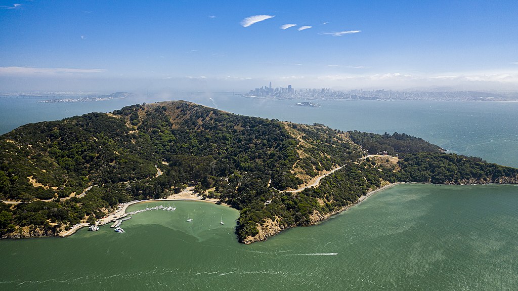
Sausalito
Time to travel: 1 hour, 29 minutes
Best time to visit: All year round
Just an hour and a half away from Sacramento is the coastal town of Sausalito. With its stunning coastal views and beautiful bay, it’s no wonder why it’s one of the best day trips from Sacramento!
Take a stroll along the Sausalito boardwalk or go kayaking in Richardson Bay. You can also walk along the docks and view the houseboats lining the marina.
Not only can you walk around Sausalito, but you can also head to Marin Headlands for hiking the trails such as Hawk Hill, Kirby Cove, or Rodeo Beach.
For your meals, grab a coffee at Cibo or head on over to the Fish restaurant for local seafood. You’ll also want to check out Lapert’s for its quirky flavors of ice cream!
Santa Rosa
Time to travel: 1 hour, 43 minutes
Best time to visit: All year round
One of the best day trips from Sacramento is Santa Rosa, the largest city in Sonoma County with so much to do and explore! Home to the world-famous Charles M. Schulz Museum, it’s an excellent destination for art and history lovers. The vibrant and historic downtown area is known as Railroad Square and has plenty of local shops and restaurants to explore.
Be sure to stop at Nimble and Finn’s for an ice cream cone or eat some traditional Thai food at Khoom Lanna Thai Cuisine.
Not only are there small-town activities, but you can also find plenty to do outdoors. Santa Rosa offers scenic trails at Sugarloaf Ridge State Park and a wealth of parks like the Jack London Historic State Park or the Trione-Annadel State Park. You can even experience a safari in the middle of California by visiting Safari West.
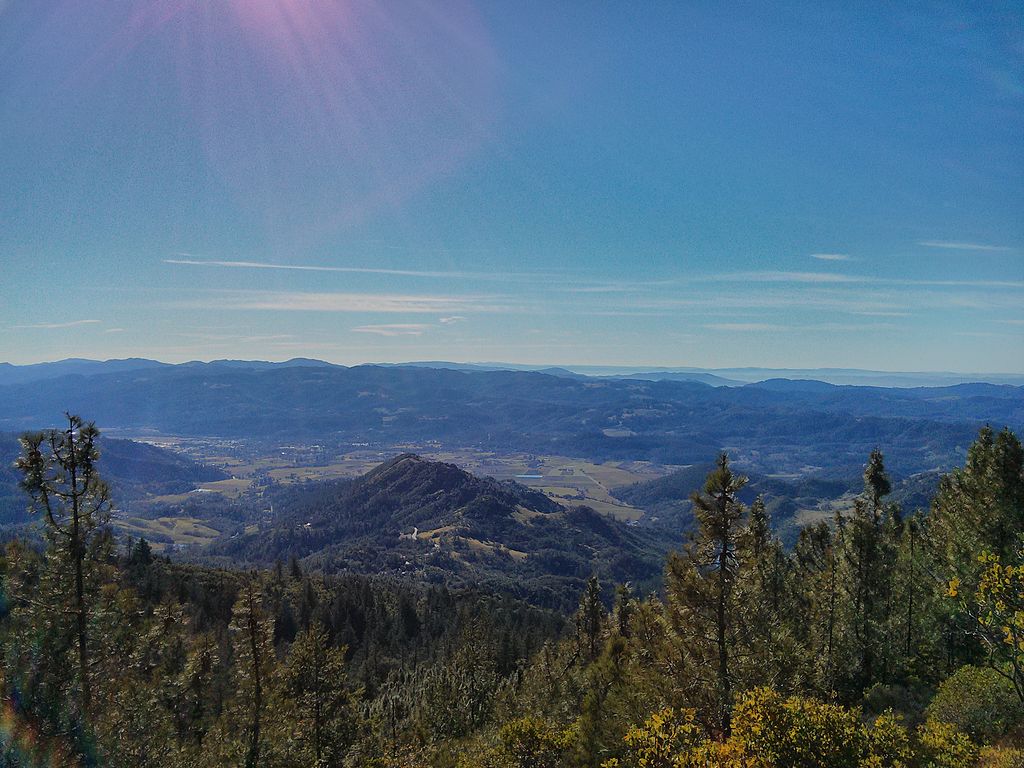
Sonora
Sonora, California
Time to travel: 1 hour, 51 minutes
Best time to visit: All year round
Travel just short of 2 hours from Sacramento and you’ll find yourself in Sonora, a former gold mining town located in the foothills of the Sierra Nevada Mountains.
If you love being outdoors, Sonora is the perfect place for you! Take a scenic hike at Dragoon Gulch Trail to see the city of Sonora at the summit or go swimming in a cave at the Natural Bridges Trail.
For those looking to explore more of the town’s history, check out Sonora’s Historic Downtown District where you can visit some of the old buildings that were built during the Gold Rush days in the 1860s.
You won’t want to miss out on the farm-to-table restaurant of Emberz or scouring through all the cute antique shops lining the street.
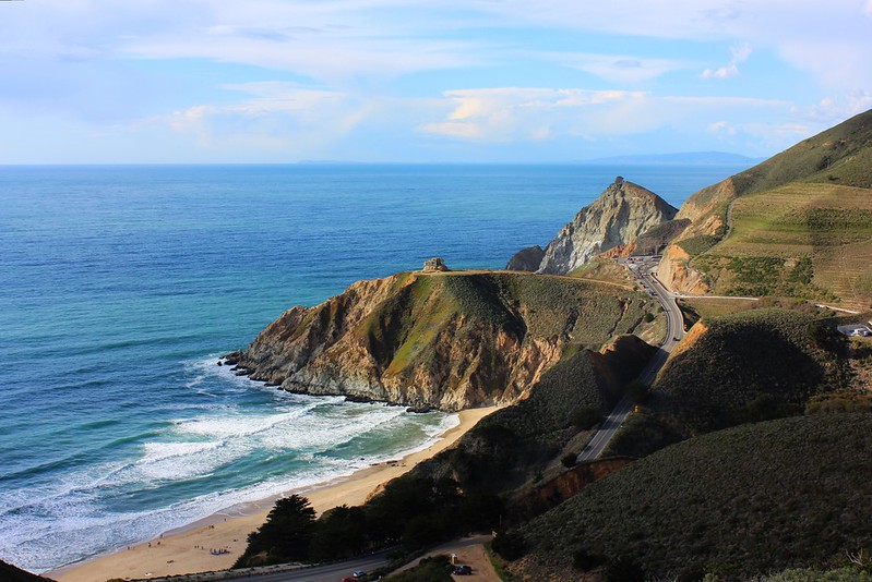
Bodega Bay
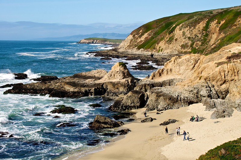
Bodega Head Beach
Time to travel: 2 hours, 7 minutes
Best time to visit: Fall, Winter, Spring
On a 2-hour drive from Sacramento is Bodega Bay, a picturesque fishing community and popular tourist destination known for being the setting of Alfred Hitchcock’s horror film, Birds. From the waterfront views to nature hikes, there’s plenty of seafood to enjoy and nature to explore.
Explore Bodega Head which has breathtaking views of the bay or visit Doran Beach for swimming, paddleboarding, or kayaking. You can also hike on the Bird Walk Coastal Access Trail to catch sight of birds like pelicans.
Stop by the famous Spud Point Crab Company for some of the freshest seafood you’ll ever taste and then take a stroll along the beach and watch for migrating whales.
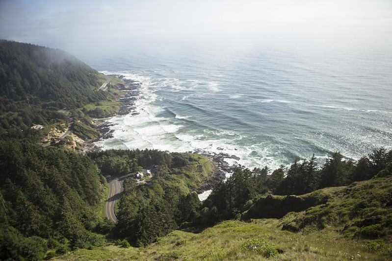
Half Moon Bay
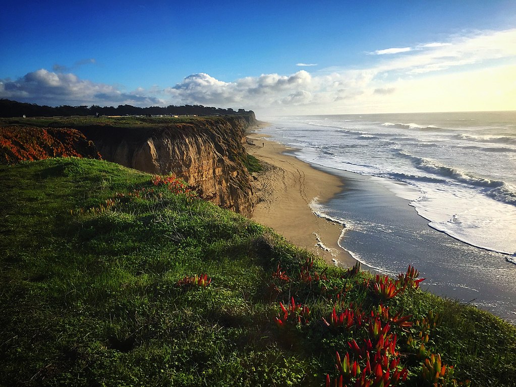
View of the coastal cliffs in Half Moon Bay, California
Time to travel: 2 hours, 10 minutes
Best time to visit: Fall, Spring, Summer
Just an hour away from Sacramento is Half Moon Bay, a stunning coastal town with some of the best beaches in Northern California. From the harbor to the cliffside trails, you can experience breathtaking views and outdoor activities like surfing or fishing. You’ll quickly discover that Half Moon Bay is one of the best day trips from Sacramento.
Some of the beaches to visit in Half Moon Bay are Pillar Point Harbor and Mavericks, a world-renowned surfing beach. For those looking to explore nature, the Fitzgerald Marine Reserve is a great spot for tide-pooling and birdwatching.
A visit to Half Moon Bay wouldn’t be complete without stopping at Barbara’s Fish Trip for seafood or tasting some of the delicious local wine from Half Moon Bay Winery.
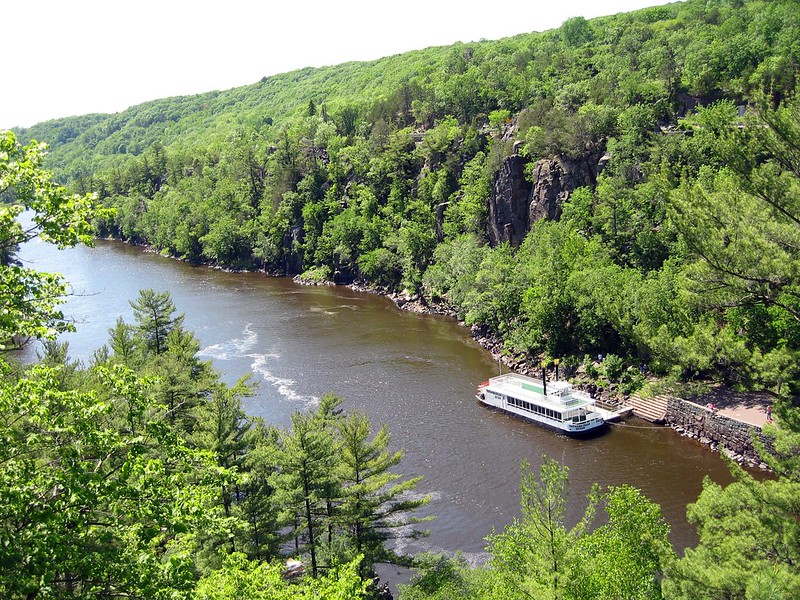
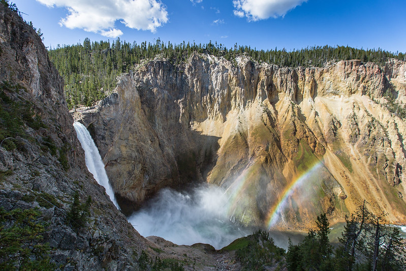
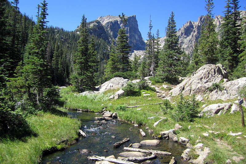
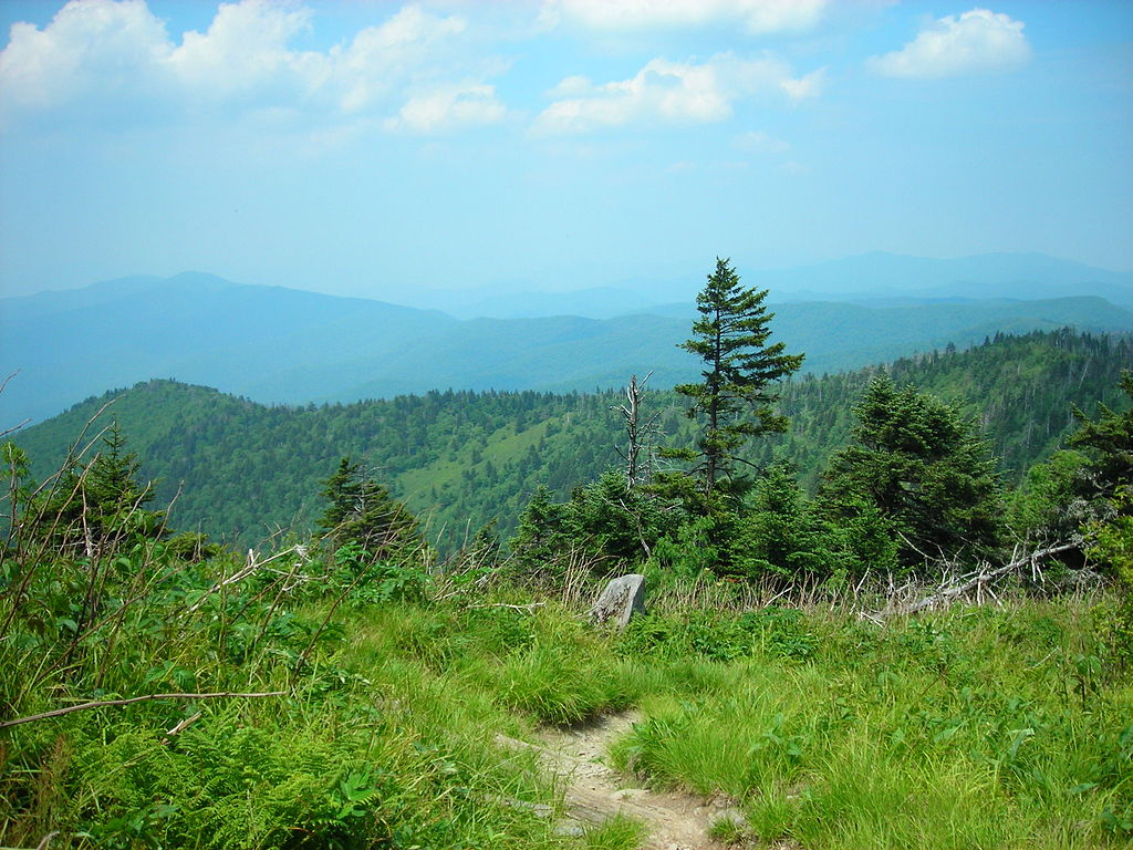
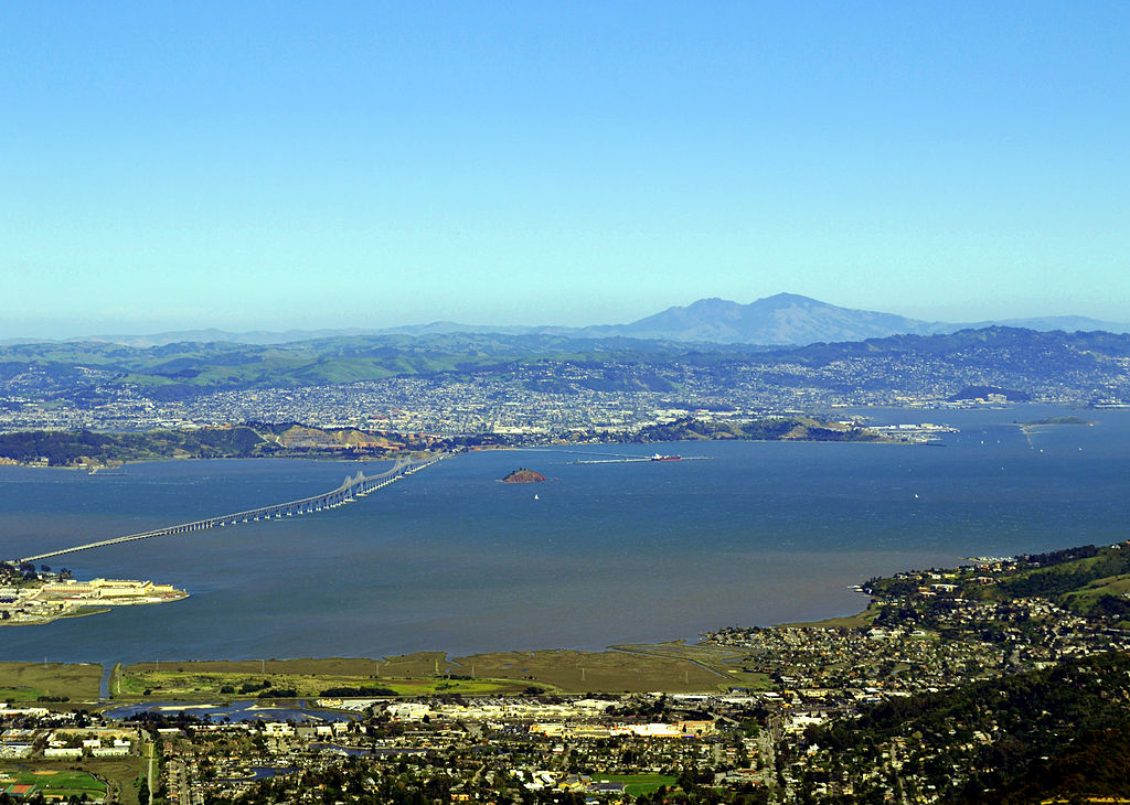
Lake Tahoe
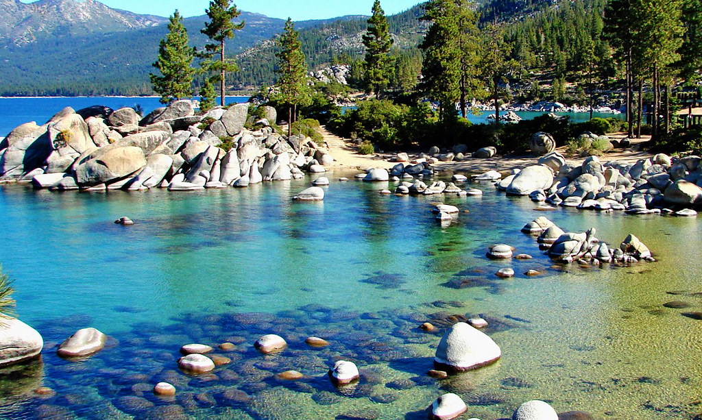
Clear Waters, Sand Harbor, Lake Tahoe
Time to travel: 2 hours, 12 minutes
Best time to visit: Spring, Summer, Fall
A scenic 2-hour drive will take you on a day trip from Sacramento to Lake Tahoe. This gorgeous glacial lake is the perfect destination for outdoor activities like camping, fishing, swimming, and biking. Lake Tahoe is open in the winter for outdoor activities, but be sure you’d like to be there for the cold weather!
Start with a hike on the trails of Emerald Bay State Park or grab some gear and go kayaking on Lake Tahoe. You can also take a boat cruise directly on Lake Tahoe from the Zephyr Cove Marina during the daytime or take a sunset dinner cruise.
For a great breakfast spot, check out the Getaway Cafe for their coconut-crusted french toast. You’ll also want to the Base Camp Pizza Co. for some unique flavors of pizza!
San Francisco
Time to travel: 2 hours, 16 minutes
Best time to visit: All year round
San Francisco is a must-see for any day trip from Sacramento. With its iconic Golden Gate Bridge and beautiful coastal drives, this city is a must-see! You can choose to visit the world-renown Alcatraz, or just view it from shore, walk through Pier 39 to watch the sea lions, or take a stroll through Chinatown.
Other well-known places to explore in San Francisco are Golden Gate Park, Ghiradelli Square, and seeing Lombard Street. For a unique experience, take a ride on the vintage San Francisco cable cars or visit the Ferry Building Marketplace to sample some of the city’s best local flavors.
To really get the full San Francisco experience, you can’t miss out on its amazing food scene. From seafood dishes at Fisherman’s Wharf to traditional Italian cuisine in North Beach and Mexican favorites in Mission District—you’ll be sure to find your new favorite!
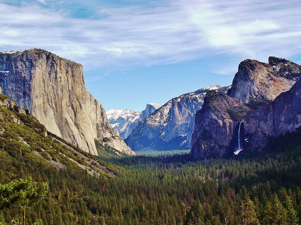
Yosemite National Park

Yosemite Valley from Wawona Tunnel Vista Point
Time to travel: 2 hours, 44 minutes
Best time to visit: Late spring-early fall
If you’re looking for a more adventurous day trip from Sacramento, Yosemite National Park is the perfect destination! From majestic waterfalls to lush meadows and valleys, this national park has it all.
Take a moderate hike on the Mist Trail to see Nevada Falls, or stroll around Mirror Lake Trail and catch sight of Half Dome. There are also other iconic points to explore like Glacier Point, El Capitan, and Mariposa Grove.
No matter where you go in Yosemite National Park, you’ll be sure to have an unforgettable time. Don’t forget to bring your camera for some great shots!
Final Thoughts: Day Trips from Sacramento
Whether you’re looking for a relaxing day by the coast or an adventure in a national park, Sacramento has plenty of great day trip options. From Bodega Bay to Yosemite National Park, these spots offer a variety of landscapes and activities to enjoy!
Which day trip from Sacramento is on your list? Share it with us below!