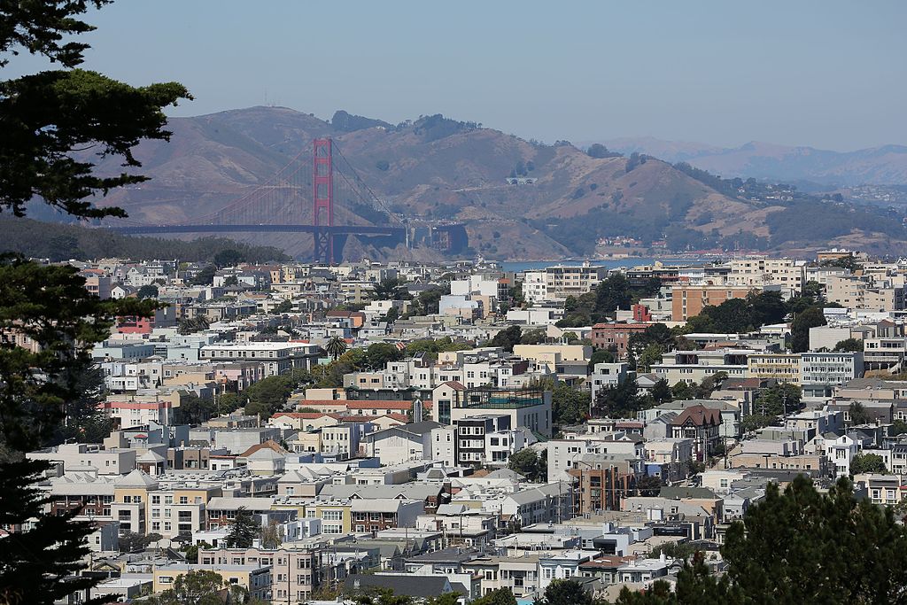
From Napa to the South Bay, The San Francisco Bay Area is one of the most picturesque regions in the United States. The hilly region sits right next to the Pacific Coast, and with plenty of bays and waterways, it is a hiker’s paradise, with ample opportunities to take in great vistas. If you are looking for the best of the best, read our list of the best hikes near San Francisco with panoramic views.
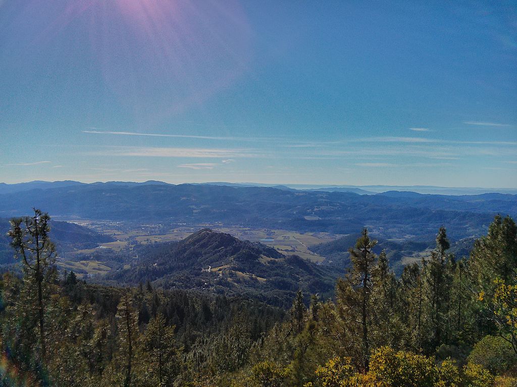
Bald Mountain Loop
Where: Sugarloaf Ridge State Park | Napa and Sonoma
Level: Moderate | 6.8 miles roundtrip | Elevation Change 1,500 feet
A climb along serpentine-dotted slopes leads to the grass-covered summit of Bald Mountain, Sonoma County’s answer to Marin’s Mount Tamalpais.
Although the grassy summit of Bald Mountain is the crowning glory of this loop trip in Sugarloaf Ridge State Park, each leg of the route bestows its rewards. We recommend taking the most direct path to the summit and then looping back downhill on a series of trails for a roundabout tour of the park’s varied terrain.
Start your trip on Lower Bald Mountain Trail, which meets up with Bald Mountain Trail up to the summit. On the way back down, we recommend connecting Gray Pine Trail, Red Mountain Trail, Headwater Trail, and Vista Trail to return to your car. Along the way, you’ll take in wildflowers, chaparral, and unobstructed panoramic views of the nearby hills and mountains.
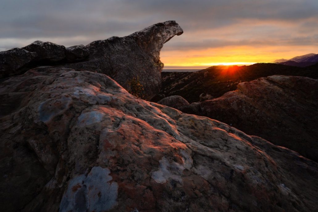
Mount St. Helena
Panoramic view over Calistoga from the top of Mount St. Helena
Where: Robert Louis Stevenson State Park | Napa and Sonoma
Level: Strenuous | 10.6 miles roundtrip | Elevation Change 2,100 feet
Pick a crystal-clear day for this epic trek to the highest summit in the Wine Country, where the vista can expand to more than 100 miles.
Normally a trail that is 80 percent fire road would not interest me in the slightest, but the spectacular view from the top of Mount St. Helena makes the climb on its wide, expose road completely worthwhile. And, unlike other Bay Area peaks bearing world-class vistas, such as Mount Diablo and Mount Tamalpais, Mount St. Helena has no public automobile access to its summit. This is one of the best hikes near San Francisco where the panoramic view must be earned with some effort.
For the best possible trip, pick a cool, clear day in late autumn, winter, or spring. Forget the hot days of summer. Then pack along the finest picnic lunch you can put together, drive to the trailhead and start climbing.
Start at the Stevenson Memorial Trail, which later joins with the Mount St. Helena Fire Road. At the top, take in views of Lake Berryessa and the Sierra Nevadas to the east. To the southeast lies Mount Diablo, and a clear-day panoramic view of Mount Shasta to the north, nearly 200 miles in the distance.
Table Rock
Where: Robert Louis Stevenson State Park | Napa and Sonoma
Level: Moderate | 4.6 miles roundtrip | Elevation Change 1,000 feet
Take a walk on the ‘other side’ of Robert Louis Stevenson State Park, where a single-track trail leads to a rock outcrop with an amazing view.
If you’re not feeling ambitious enough to tackle the 10-mile roundtrip to mighty Mount St. Helena, there’s another worthwhile reason to drive the winding 9 miles on Highway 29 from Calistoga to Robert Louis Stevenson State Park. It’s the Table Rock Trail, a much easier hike that offers some of the best panoramic views in the San Francisco Bay Area’s wine country.
A mere 4.6 miles round-trip, with only a moderate amount of up and down, leads you to the craggy summit of Table Rock, a large block of igneous rock with sheer drop-offs on three sides. This moonscape-like rock outcrop with its crags, gullies, and pockmarks is fascinating enough from a geological perspective, but it’s the view from the top – a postcard panorama of the Napa Valley – that you will long remember.
The trailhead lies on Highway 29 directly across from the trailhead for Mount St. Helena. Along the hike you’ll pass through a canopy of tanoaks, madrones, and Douglas firs, with Mount St. Helena visible to the west, looming 2,000 feet above you while green hills and vineyards line the alley below.
Barnabe Peak Loop
Where: Samuel T. Taylor State Park | Marin
Level: Moderate | 6 miles roundtrip | Elevation Change: 1,300 feet
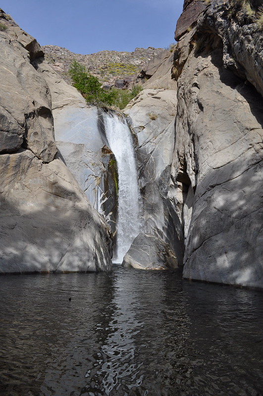
An intimate waterfall, a fern rainforest, and a summit with a big view are found on this loop trail in western Marin County, one of the best hikes near San Francisco with a panoramic view.
Although it is a much older public parkland, Samuel P. Taylor State Park is somewhat overshadowed by its larger and more famous neighbor, Point Reyes National Seashore.
For hikers, that’s a bonus. Even when Samuel P. Taylor’s campground is filled to the limit on summer weekends, it’s rare to find many people on its hiking trails. But that’s just fine with those who know and love the park; they can enjoy a little solitude along with the scenery. The park’s best hike with a panoramic view is a loop trip to Barnabe Peak, a 6-mile trek that leads through a ferny, mossy forest of bay trees, passes by a wet-season waterfall, and then culminates with the summit of Barnabe Peak at 1,466 feet.
The trailhead isn’t at the main Samuel P. Taylor campground entrance; it’s 1 mile west on Sir Francis Drake Boulevard, near Devil’s Gulch Horse Camp. Park in the dirt pullout across the road from the camp and then walk up the paved camp road for 100 yards until you reach a trail cutting off to the right along Devil’s Gulch Creek, paralleling the road.
Verna Dunshee Trail and Gardner Lookout
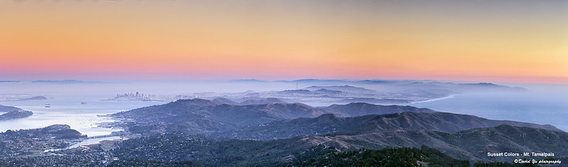
Sunset view from Mount Tamalpais over the San Francisco Bay
Where: Mount Tamalpais State Park | Marin
Level: Easy | 1.4 miles roundtrip | Elevation Change: 170 feet
One of the Bay Area’s most famous peaks is circled by an easy loop trail that offers 360-degree panoramic views over San Francisco and the entire Bay.
If it’s a clear day and you’re in the mood to feel on top of the world, head for the summit of Mount Tamalpais and the Verna Dunshee Trail. The trail is short, wheelchair accessible, and stroller-friendly, and features top-notch panoramic views of Marin County, San Francisco, and beyond as it loops around the mountain’s summit.
To add a little challenge to the trip, you can also hike the short but steep path to the tip-top of Mount Tamalpais East Peak, where a closed fire lookout tower allows for an all-in-one-glance panoramic view over the San Francisco Bay Area.
The drive up Mount Tamalpais is part of the adventure. From Pantoll Road upward, the mountainside views are compelling enough that you have to remind yourself to keep your eyes on the pavement. Close attention is essential, because the summit road is narrow and winding, leaving little room for error.
Coastal Trail and Hill 88 Loop
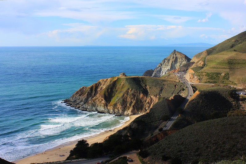
View over the Pacific Ocean from the Coastal Trail
Where: Golden Gate National Recreation Area | Marin
Level: Moderate | 5.5 miles roundtrip | Elevation Change: 1,000 feet
A hike high above the Marin Headlands’ busiest beach leads to an overlook with an unbeatable panoramic coastal view of the San Francisco Bay Area.
At one time, the Coastal Trail at Rodeo Beach was a paved road, but over the years, weather and erosion have taken their toll. The trail has been rebuilt, rerouted, and reworked so many times that today the path is patchwork: part paved road, part dirt road, part single-track, and part wooden stairs.
But its destination remains the same: The Coastal Trail leads from Rodeo Beach to the top of mighty Hill 88 in the Marin Headlands, providing what many consider to be the finest views in the Golden Gate National Recreation Area– a park rife with memorable panoramic views over the San Francisco Bay Area.
North Ridge and Sunset Trail Loop
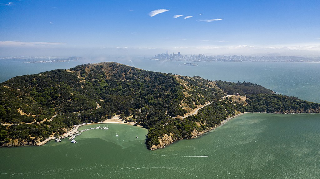
Located in the middle of the San Francisco Bay, Angel Island offers incredible panoramic views
Where: Angel Island State Park | Marin
Level: Easy/Moderate | 4.5 miles roundtrip | Elevation Change 780 feet
Visit the summit of Mount Livermore, the highest point on Angel Island, on this view-filled half-day hike. It’s one of the best hikes in the San Francisco Bay Area with a panoramic view.
Do you want to visit Angel Island but can’t bear to hike on the pavement? You don’t like sharing the trail with bikers and want a hikers-only path? No problem. There are two completely different ways to hike Angel Island: One path is on the wide, paved Perimeter Trail, which circumnavigates the island. The other path is the dirt and mostly single-track North Ridge and Sunset Trail Loop, which travels to the island’s highest point, the summit of Mount Livermore.
Wildcat Peak and Laurel Canyon Loop
Where: Tilden Regional Park | East Bay
Level: Easy | 3.5 miles roundtrip | Elevation Change: 500 feet
This easy trail to the panoramic summit of Wildcat Peak makes a perfect leg-stretching hike for a Sunday afternoon.
Most people think of Tilden Park as a place to take the kids. The park has pony rides, a carousel, a miniature train, a swimming beach at Lake Anza, and lots of other diversions that keep children occupied and happy. But over on the northwest edge of the park lies the Tilden Nature Area, a very different part of Tilden Park. Here, the only amenities are trail signs and the only diversions are the natural beauty and the panoramic views over the San Francisco Bay Area.
Mount Diablo Grand Loop
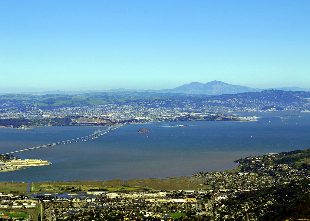
Mount Diablo looming in the background of the San Francisco Bay
Where: Mount Diablo State Park | East Bay
Level: Butt-kicker | 10 miles roundtrip | Elevation Change: 2,900 feet
For an unforgettable day, circumnavigate the tallest peak in the East Bay and visit its two neighboring summits, Eagle Peak and North Peak.
Most everybody thinks about making a trip to 3,849-foot Mount Diablo from time to time. After all, you see it from just about everywhere in the Bay Area. It’s not the tallest mountain in the San Francisco Bay Area (Mount Hamilton near San Jose is 360 feet taller), it just has a way of making its presence known, looming in the background of the lives of millions of East Bay residents.
When your time to visit Mount Diablo arrives, make your first stop at the top. Drive to the summit and see what it’s like to look at the greater Bay Area from Mount Diablo rather than vice versa. Park as close to the top as possible and then walk up to the observation deck for a 360-degree vista. On the clearest of days, you can see all the way to the Sierra Nevadas and Mount Lassen. After being thoroughly wowed by the summit view, you are inspired to hike this 10-mile loop around the peak, which adds in two side trips to equally inspiring Eagle Peak and North Peak. The route includes substantial ups and downs, but you are rewarded with sweeping views and a variety of mountain flora.
Mission Peak
Where: Mission Peak Regional Preserve | East Bay
Level: Strenuous | 6.6 miles roundtrip | Elevation Change: 2,000 feet
A challenging hike to a popular summit near Fremont, where hang gliders soar past at eye level.
The grassy slopes of 2,517-foot Mission Peak are a requisite hike for outdoor lovers in Alameda County. On any sunny weekend day with good visibility, hundreds of East and South Bay residents make the pilgrimage to Mission Peaks’ summit.
At the top, they enjoy first-rate panoramic views of the South Bay, the northern Santa Cruz Mountains, the Peninsula, San Francisco, and even the summits of the Sierra Nevadas. Along the way, they are entertained by colorful hang gliders and paragliders taking off from Mission Peak’s slopes and then soaring with the thermals high overhead.
The trail to Mission Peak is a wide, exposed fire road, so be sure to wear your sunscreen. Also, forget hiking on hot days. Some of the grades are quite steep, and with its shadeless slopes, the peak can bake in summer.
Although the trail has a reputation for being a butt-kicker, it’s only 3.3 miles to the summit from the main Fremont trailhead, and even children can make the trip in cool weather. Just remember to bring along plenty of water and snacks and take your time.
Montara Mountain Summit
Where: McNee Ranch State Park and Montara State Beach | Peninsula and South Bay
Level: Strenuous | 7.4 miles roundtrip | Elevation Change: 2,200 feet
On a clear day, this coastal mountain offers sweeping bay-to-ocean panoramic views, taking in everything from Mount Diablo to the shoreline from San Francisco to Pescadero.
There are two routes to Montara Mountain’s summit. The dog-friendly route and the no-dogs-allowed route. Both trails yield good hiking, and the summit vista is sublime no matter how you get there.
The no-dogs-allowed trail begins in Pacifica’s San Pedro Valley County Park and is the preferred choice for hikers who love single-track. You won’t encounter any mountain bikers on this path (except in the last 1.1 miles to the summit. where the two trails join), but you can’t bring your dog, either.
The dog-friendly hiking route begins in McNee Ranch, a unit of Montara State Beach on Highway 1 just north of Montara. It’s an old paved road that transitions into a dirt fire road as it climbs the mountain, and it is open to hikers, bikers, equestrians, and dogs.
The road/trail serves up expansive coastal panoramic views as it winds up Montara Mountain’s western slope. One advantage of taking this route is that you don’t have to hike all the way to the summit to gain a panoramic vista.
The scenery is good for most of the trip. If you do go all the way, you can take an alternative route back down the mountain, making a semi-loop.